
MLSH - Seminar Series 2022-23
Introduction
“Models, Learning and Sensing in Hydrology” is a webinar series initiated by The Center for Water Informatics & Technology at LUMS. This new series (MLSH) is primarily meant for discussing serious scholarship in the emerging topics of physics-guided machine learning, evolutionary dynamical systems, data assimilation of mobile sensors, AI-powered edge computing systems, and autonomous systems in water, agriculture and similar application areas. The series celebrates distinguished works in the field and is aimed towards researchers, practitioners, and technical experts in hydrology-related areas. Please note that many of the speakers may or may not have a direct interest in the Indus or South Asia’s other basins.
The seminar sessions are streamed live via zoom and participation requires registration. Once registered, participants will automatically receive alerts for all future talks.
Series Organizers
- Jawairia Ashfaq Ahmad Post Doctorate Fellow and Adjunct Faculty, Center for Water Informatics & Technology (WIT), LUMS
- Talha Manzoor Assistant Professor of Research, Center for Water Informatics & Technology (WIT), LUMS
- Zahra Lakdawala Associate Professor of Mathematics, LUMS
- Abubakr Muhammad Associate Prof. & Chair, Dept. of Electrical Engineering, Executive Director, Center for Water Informatics & Technology (WIT), LUMS
Abstracts and Videos
Detection and mapping of shifts in dominant hydrologic processes, plant water stress and drought cascade using satellite data

Dara Entekhabi,
Professor, Barcadi and Stockholm
Water Foundations Chair
Massachusetts Institute of Technology (MIT)
Date and time: 6:00 - 7:00 pm PKT, Wednesday, February 09, 2022
About the talk: In the hydrologic sciences, as in other scientific and engineering disciplines, notable advances follow the introduction of new types of measurements. New types of measurement shed light on processes that are not apparent with prior observing systems. Models too are affected. Models are developed to best match observations. Once a new type of observation becomes available, it poses new questions for models. In the hydrologic sciences, soil moisture has always been the state-variable of models, linking fluxes such as runoff, drainage and evapotranspiration. in situ sensors for measuring soil moisture are sparse and inadequate for mapping and for practical use in constraining models. In the recent few years, the capability to measure this state-variable has emerged with new technologies for microwave remote sensing. Global fields of surface soil moisture and vegetation water content are now available. In this presentation, the following three questions are addressed, given the recent availability of the new type of measurements: 1) how are the land surface water and energy balance coupled and what does this imply for regional vulnerability to climate change?, 2) how and when do vegetation and crops respond to water stress?, and 3) how do droughts develop and expand across the landscape?
What is the Optimal Mixture of Space-borne Sensors for Remote Sensing of Terrestrial Freshwater?: A Comparative Analysis of Passive Optical, Passive Microwave, Active Microwave, and LiDAR Retrievals
Barton A. Forman,
Associate Professor,
Department of Civil and Environmental Engineering,
University of Maryland, College Park, MD
Date & Time: 6:00 - 7:00 pm PKT, Wednesday, February 23, 2022
About the talk: An observing system simulation experiment (OSSE) is used to evaluate different observing strategies of terrestrial freshwater and to help create a mission planning tool with a particular focus on the coupled snow-soil moisture-vegetation system at the land surface. The NASA Land Information System (LIS) is used to model the spatiotemporal dynamics of the hydrologic cycle. LIS is then linked to the Trade-space Analysis Tool for Constellations (TAT-C) in order to provide a realistic view of land surface conditions as seen by a given space-borne sensor that is then used to generate synthetic, space-borne retrievals of snow, soil moisture, and vegetation. The merger of LIS with TAT-C enables the simulation of different mixtures of space-borne sensors designed to explore the trade-off in scientific utility related to passive microwave radiometry, microwave RADAR, and optical LiDAR. An ensemble-based data assimilation framework is employed to systematically merge (in a Bayesian sense) the land surface model with the space-borne retrievals of snow, soil moisture, and/or vegetation. The results from the OSSE enable systematic comparisons across a wide range of different observing system strategies and can help program managers decide what is the optimal mixture of sensor types, orbital configurations, senor resolutions, and instrument errors in order to achieve a predefined scientific benchmark. The end result of this project will be a framework to help decide how to harness the information content of Earth science mission data in order to best characterize the spatiotemporal dynamics of freshwater in the natural environment.
Data Assimilation of the Terrestrial Water Cycle: Applications
Manuela Girotto
Assistant Professor,
Department of Environmental Science,
Policy, and Management,
University of California, Berkeley
Date & Time: 8:00 - 9:00 pm PKT, Monday, April 18, 2022
About the talk: The goal of Data assimilation is to provide a better estimate of the environmental states than either models or observations could individually do. This presentation will focus on benefits, challenges and applications of recent land surface data assimilation research efforts targeted at improving snow, soil moisture, groundwater, and terrestrial water storage hydrological states.
Uncertainty quantification of numerical models: From water resources, mine water management up to geothermal applications
Carlos Andres Rivera Villarreyes
Global Product Specialist FEFLOW,
Danish Hydraulic Institute (DHI),
Germany
Date & Time: 6:00 - 7:00 pm PKT, Wednesday, May 11, 2022
About the talk: Geophysical and more broadly geoscientific applications have many sources of uncertainties, arising from, for instance, unresolved and unaccounted physical processes, inaccurate geometrical information, and variations in the parameter distributions. Several methodologies exist to quantify the uncertainty behind numerical models used for flow and transport processes in water resources and geothermal applications. However, there is not a current agreement about the methodology, especially when numerical modelling is applied in the industry. In many cases, even the uncertainty is not addressed. In the present study, we focus on the uncertainty associated to the parameter distributions. Mostly, parameter values are locally known in some locations nearby exploration wells. At a large (and regional) scale, lithological information is understood, but the variability of the hydraulic and thermal parameters at that scale may be large. Thus, several assumptions are usually made for the reservoir simulations (homogenization techniques). This leads to a high degree of uncertainty in the model predictions such as fluid pressure and temperature distributions. We discuss two cases (mining and geothermal applications) and demonstrate the impact of parameter uncertainty to model predictions. On the one hand, numerically expensive methods such as Monte Carlo are used to estimate flows to a mine. On the other hand, Iterative Ensemble Smoothing techniques are used to reduce the numerical effort for the uncertainty quantification in a modelling exercise in a deep geothermal reservoir in Germany.
How's it Growing? Using Earth Observation Data for Responsive Food Security
Ritvik Sahajpal
Associate Research Professor,
Dept. of Geographical Sciences, University of Maryland.
Crop Condition Co-Lead, NASA Harvest.
Data Advisory Council member, Foundation for Food and Ag Research.
Date & Time: 6:00 - 7:00 pm PKT, Wednesday, May 18, 2022
About the talk: Yield forecasting and estimation is key to almost all food security and agricultural analysis, including ensuring market transparency, trade decisions, triggering anticipatory actions in the face of impending shortfalls, informing farmer best practices, insurance payouts, designing effective adaptation, and mitigation strategies in the face of a warming climate. This talk will comprise of three parts, in the first part, I will introduce the GEOGLAM-NASA Harvest Crop Monitors that provide a public good of open, timely, science-driven information on crop conditions and are often used to inform humanitarian organization decisions on food allocation and assistance. In the second part of the talk, I will provide an overview of the current crop yield forecasting approaches, their strengths, and limitations and present our ongoing work on developing a crop threat early warning system that attributes pre-harvest losses to potential crop threats through estimating crop conditions by integrating machine learning algorithms and earth observation (EO) data. Finally, I will highlight attributes that are key to making a yield forecasting model useful in an operational context.
Progress toward the accurate characterization of the terrestrial hydrosphere with modeling, remote sensing, and data assimilation
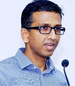
Sujay Kumar
Research Physical Scientist,
Hydrological Sciences Lab,
NASA Goddard, MD.
Date & Time: 2:00 - 3:00 pm PKT, Tuesday, June 06, 2023
About the talk: Remote sensing advancements in recent years have enabled monitoring of the Earth's land surface with unprecedented scale and frequency. In the past decades, remote sensing observations of the land surface have become available from a number of satellite instruments and platforms including soil moisture, snow depth, snow cover, terrestrial water storage, vegetation, and land surface temperature. To support the effective exploitation of the information content of the remote sensing observations, computational tools such as data assimilation are necessary. In this talk, efforts towards the concurrent use of all available remote sensing observations in a multivariate data assimilation configuration using the NASA Land Information System (LIS) will be presented. In addition to describing the advances made towards the effective utilization of remote sensing data for hydrologic prediction, some of the challenges and gaps that remain will also be discussed.
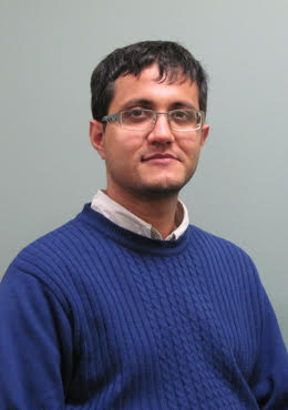
Fast and accurate estimation of evapotranspiration for smart agriculture
Weiyu Li
Ph.D. Candidate in Energy Science and Engineering,
Stanford University.
Date & Time: 10:00 - 11:00 am PKT, Wednesday, June 14, 2023
About the talk: The ability to quantify evapotranspiration (ET) is crucial for smart agriculture and sustainable groundwater management. Efficient ET estimation strategies often rely on the vertical-flow assumption to assimilate data from soil-moisture sensors. While adequate in some large-scale applications, this assumption fails when the horizontal component of the local flow velocity is not negligible due to, for example, soil heterogeneity or drip irrigation. We present novel implementations of the ensemble Kalman filter (EnKF) and the maximum likelihood estimation (MLE), which enable us to infer spatially varying ET rates and root water uptake profiles from soil-moisture measurements. While the standard versions of EnKF and MLE update the predicted soil moisture prior to computing ET, ours treat the ET sink term in Richards' equation as an updatable observable. We test the prediction accuracy and computational efficiency of our methods in a setting representative of drip irrigation. Our strategies accurately estimate the total ET rates and root-uptake profiles and do so up to two-orders of magnitude faster than the standard EnKF.
Complete Schedule
Date & Time | Speaker | Topic | Media |
|---|---|---|---|
6:00-7:00 pm PKT February 09, 2022 | Dr. Dara Entekhabi Professor, Barcadi and Stockholm Water Foundations Chair, MIT | Detection and mapping of shifts in dominant hydrologic processes, plant water stress and drought cascade using satellite data | |
6:00-7:00 pm PKT February 23, 2022 | Dr. Barton A. Forman Associate Professor, Department of Civil and Environmental Engineering, University of Maryland | What is the Optimal Mixture of Space-borne Sensors for Remote Sensing of Terrestrial Freshwater?: A Comparative Analysis of Passive Optical, Passive Microwave, Active Microwave, and LiDAR Retrievals | [Flyer] |
8:00-9:00 pm PKT April 18, 2022 | Dr. Manuela Girrotto Assistant Professor, Department of Environmental Science, Policy and Management, University of California, Berkeley | Data Assimilation of the Terrestrial Water Cycle: Applications | |
6:00-7:00 pm PKT May 11, 2022 | Dr. Carlos Rivera Villarreyes Global Product Specialist FEFLOW, | Uncertainty quantification of numerical models: From water resources, mine water management up to geothermal applications | |
6:00-7:00 pm PKT May 18, 2022 | Dr. Ritvik Sahajpal Associate Research Professor, Dept. of Geographical Sciences, University of Maryland. | How's it Growing? Using Earth Observation Data for Responsive Food Security. | |
2:00-3:00 pm PKT June 06, 2023 | Dr. Sujay Kumar Research Physical Scientist, | Progress toward the accurate characterization of the terrestrial hydrosphere with modeling, remote sensing, and data assimilation | |
10:00-11:00 am PKT June 14, 2023 | Weiyu Li Ph.D. Candidate in Energy Science and Engineering, | Fast and Accurate Estimation of Evapotranspiration for Smart Agriculture. | [Flyer] |