
WIT Summer Mentorship Programme 2024
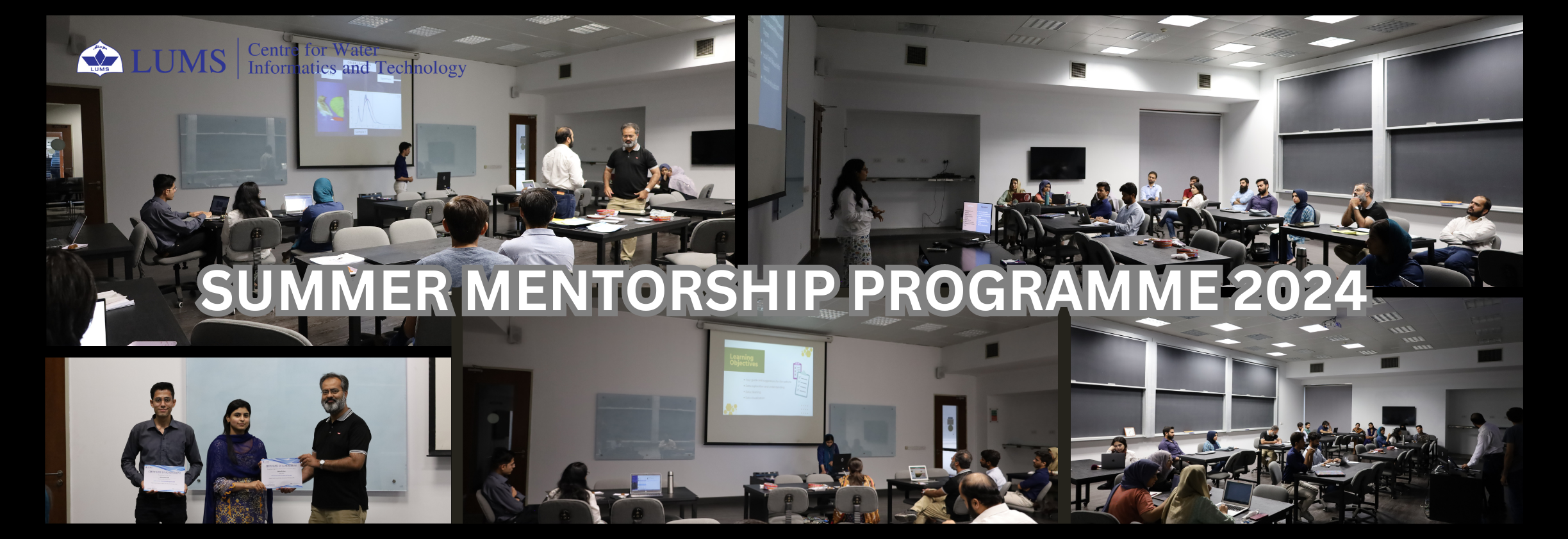
The Centre for Water Informatics and Technology (WIT) invites undergraduate students to apply for its Summer Mentorship Program (SMP) 2024. This one-month program offers students the chance to work on innovative projects that contribute to WIT's research agenda. Participants will gain hands-on experience, mentorship from WIT faculty and staff, and a stipend upon successful completion. The program runs from June 20, 2024, to July 19, 2024. Apply by June 02, 2024, to join us in advancing water informatics and technology.
Projects Overview: A total of 12 projects are available from the following domains:
- 1 in machine learning and data analysis
- 1 in remote sensing and GIS
- 3 in project management and stakeholder mapping
- 3 in software and systems implementation
- 4 in IoT and electronics
Duration: The WIT SMP 2024 will take place from June 20, 2024 to July 19, 2024. Applications will be accepted till June 02, 2024.
Eligibility: Undergraduate students from all universities are eligible to apply. Depending on the nature of the work, students of only some specific disciplines may be asked to apply for a particular project. Details for each individual project are published prior to the call for applications. Note that while students from outside Lahore are also eligible to apply, they must arrange their own accommodation for the project duration.
Selection Procedure: Students apply for specific projects in the shared project list. Student applications will be reviewed by the WIT faculty, and successful applications will be notified accordingly. Each project is assigned to a mentor from the WIT staff who will supervise the student during the program.
Compensation: Each student will receive a stipend of PKR 20,000, which will be awarded after successfully completing the program.
Project Presentation and Report: At the end of the program, the student will present their work in a joint session and submit a written report. These will be evaluated by the WIT faculty to rank the projects for the best project award.
Best Project Award: The winner of the best project award will receive support to continue the project for an additional period of one month. In addition to the stipend for the extended duration, the student-mentor pair will also have access to a small grant of PKR 50,000 that can be utilized for travel, training, and purchase of materials and equipment related to the project activities.
How to apply: Interested candidates must send their applications by email titled "WIT SMP 2024 Application" to hrwit@lums.edu.pk. The email must include the applicant's CV, academic transcripts, and a cover letter (no more than 300 words) detailing why the applicant is best suited for the proposed work. In the email, the applicant must clearly specify the project for which the application is being submitted. A maximum of two projects can be applied for (with preferences 1 and 2 clearly mentioned).
Below are details for the available projects in summer 2024.
Projects for WIT SMP 2024
Available projects: A total of 12 projects are offered. The list of projects for the year 2024 can be found below
- Machine Learning and Data Analysis:
- Remote Sensing and GIS:
- Project Management and Stakeholder Mapping:
- Software and Systems Implementation:
- IoT and Electronics:
Machine Learning for Earth Sciences.
Mentor: Hamza Rafique, PhD Student, WIT.
Majors: Computer Science/Electrical/Environmental Engineering and related disciplines.
Necessary Skills: : Basic programming (python/ JavaScript etc.) and fundamentals of Machine learning.
Description: WIT has indigenously developed IoT-based soil moisture monitoring network, which is one of the largest networks in the Indus Basin. This cost-effective network provides valuable information such as soil moisture and crop water deficit which is being used by farmers and industrial partners in real time, aiding in on-farm decision-making and regional demand estimation for irrigation. The provision of continuous soil moisture data to the farmers is critical. However, this data is provided to the farmers based on a single source, i.e. soil moisture sensor deployed on his field. During the period when a sensor node is inactive due to any technical fault, the farmer gets no information regarding soil moisture which may lead to sub-optimal irrigation, causing loss of yield and revenue to the farmer. Therefore, there is an urgent need to come up with a solution to provide confident data during the sensor’s downtime. The primary purpose of this project is to utilize machine learning models to ingest continuous time series data of soil moisture from WIT’s sensor network and produce high-quality estimates for the missing data. In particular, we would be implementing basic RNN and LSTM models and would target an encoder-decoder architecture based on our initial results. The project would be divided into two phases with the first phase covering the pre-processing of time series data from the network and geospatial soil moisture data of the same location from global soil moisture data products. This multi-source data would be fused in a suitable format to meet the requirements of the machine learning model. The second phase would cover the model implementation in a suitable programming language (preferably Python). While the university coursework on machine learning/ deep learning covers exercises based on AI-tailored datasets, this fast-paced project will give the selected student hands-on experience with our IoT field data and design machine learning models to provide solutions for our agriculture sector. This immersive experience would allow us to generate innovations in industrial settings where we can experience the true impact of machine learning in solving real-world problems. At the same time, this experience would surely train the candidates for the ever-growing needs of Agritech market which is expected to grow from USD 23.5 billion in 2022 to reach around USD 79.7 billion by 2030.
Analyzing Distortion Triggers in Aerial Imagery Captured by Drone
Mentor: Rida Zainab, Research Assistant, WIT.
Majors: Electrical/Electronics Engineering and related disciplines.
Necessary Skills: Basic understanding of electronics and cameras, Familiarity with Remote Sensing.
Description: We have a drone system equipped with a multispectral camera. The aerial imagery captured by the drone is used to calculate various parameters related to plant health, such as chlorophyll content and nitrogen uptake in plants. Students will analyze this imagery to identify factors causing distortions, such as variations in the reflectance range of images over time and the presence of sunspots. Their task is to determine the optimal time for capturing aerial images. Distortions may arise from incorrect timing of image capture, calibration issues with the equipment, or other environmental factors or limitations affecting images.
Mapping of Key Stakeholders in Environmental and Technological Sectors
Mentor: Ali Akbar, Business Development Manager, WIT.
Majors: Business, economics, environment, public policy.
Necessary Skills: Strong research and analytical skills, Interest in environmental technology and stakeholder management, Basic knowledge of CRM software is a plus.
Description: This project aims to develop a comprehensive directory of stakeholders across government, development, and private sectors relevant to our centre's domain. The intern will consolidate existing lists and categorize stakeholders by their value chain role (e.g., farmers, processors, academia, manufacturers, regulators, etc.) and work domain (e.g., cryosphere, agriculture, meteorology, water, technology). Additionally, the project will involve identifying best practices for stakeholder engagement and recommending suitable management software.
Grant and Project Management
Mentor: Soban Hameed, Operations Manager, WIT.
Domains: An undergraduate or graduate student with a program in business administration, management, or finance will be suitable for us.
Description: The project aims to conduct a comprehensive review of all grants and projects held by WIT from 2016 to 2024. The primary objective is to identify open items, unused budgets, and committed funds to ensure a clear and accurate financial overview. Additionally, we will tag grant names on all relevant assets and provide detailed consumption and balance information for each grant. The expected outcome is enhanced financial clarity, improved asset management, and comprehensive documentation, thereby facilitating better financial planning and decision-making. This review will not only address current issues but also establish a robust framework for managing future grants.
Asset Counting and Management
Mentor: Soban Hameed, Operations Manager, WIT.
Domains: An undergraduate or graduate student with a program in business administration, management, or finance will be suitable for us.
Description: The project aims to compile a comprehensive inventory of all assets held by WIT from 2016 to 2024. This includes documenting the acquisition dates, current holders, and locations of each asset. Once the list is complete, asset allocation emails will be sent to all employees who currently hold any assets, detailing the assets in their possession and any necessary actions they need to take. Furthermore, we will be researching and identifying suitable software or a database system to manage the issuance and receipt of assets more efficiently. This system should allow for easy tracking, updating, and reporting of asset information. It will be accessible to all Directors and Managers, ensuring they have real-time visibility and control over asset distribution and allocation within their departments.
Evaluating Open-Source GIS Platforms for Aerial Data Management
Mentor: Rida Zainab, Research Assistant, WIT.
Majors: Electrical/Electronics Engineering and related disciplines.
Necessary Skills: Basic understanding of GIS.
Description: Students will conduct a comprehensive analysis of open-source GIS platforms that support the storage, visualization, and management of aerial data. They will explore options such as GeoNode, GeoServer, QGIS Server ,and others available in the market. The analysis will focus on identifying the platform best suited to our specific use case, considering factors such as functionality, easy of use, scalability, and cost-effectiveness. The goal is to determine the most suitable platform for efficiently handling and analyzing aerial data in our project.
Implementing Agile Frameworks with Redmine Technology at WIT.
Mentor: Hamza Rafique, PhD Student, WIT.
Majors: Computer Science/Electrical Engineering/ Management sciences and related disciplines.
Necessary Skills: Basic knowledge about server hosting.
Description: The Centre for Water Informatics and Technology (WIT) is in a pressing need for hosting enhanced project management tools. The demand for improved coordination, oversight, and streamlining project workflows is paramount with a diverse team of WIT, comprising faculty members, researchers, support staff, and graduate/postgraduate students actively engaged in many projects. This project aims to address this need and offer students a practical experience in managing and coordinating projects by implementing Agile project management methodologies and to leverage Redmine technology effectively. As part of this theory and server hosting project, students will delve into the specifics of Agile, including frameworks like Kanban and Scrum. A comprehensive study would be carried out to ascertain the framework suitable to meet WIT’s requirements. In parallel, the student would be setting up the Redmine cloud server to practically implement the required project management framework. Redmine is an open-source project management and issue-tracking tool, which will be customized by the student to meet the specific needs and workflows of projects at WIT, by configuring user permissions, project trackers, and custom fields as required. Throughout this process, students will gain insights into server administration, software deployment, and implementation of Agile methodology in a real work setting, equipping them with the skills needed to effectively manage project management tools in real-world scenarios.
Custom Widgets Development on Thingsboard PE IoT Platform
Mentor: Ali Akbar, Business Development Manager, WIT.
Majors: Computer Science, software engineering, computer engineering, Electrical Engineering, Mechatronics, etc.
Necessary Skills: : Experience in JavaScript and python. Prior experience in data visualization, IoT, UI design will be preferred.
Description: The intern will enhance the usability and functionality of our IoT network’s dashboard on the Thingsboard PE platform by designing custom widgets. A key deliverable will be creating a Windrose widget for the weather stations, though many other applications can also be explored, bridging the platform's capabilities and our needs.
LoRa-Based Multi-Hop network for Flood Detection and Early SMS Warning System
Mentor: Moeen Ahmad Azam, Research Associate, WIT.
Majors: Electrical/Electronics Engineering, Computer Science.
Necessary Skills: :C programming/ Arduino/Esp32, LoRa communication and GSM module integration is a plus.
Description: This project aims to develop a LoRa-enabled flood detection and early SMS warning system with a multi-hop communication network of multiple water level sensor nodes placed 1 km (or within max range) apart. Each node will collect and forward water level data to the next node, while the foremost node will analyze the real-time and historical data to predict potential flooding based on rapidly rising water levels. Due to multi-hop network can be stretched as much as we want. Based on the past results of collected data and rate of rise of water level, percentage of the risk will be calculated and If flood risks are detected, the system will send SMS alerts to contacts in the database using a GSM module. Moreover, the fundamentals of wireless sensor networks like ultra-low power consumption and low data rates will be kept in view during design. The project will involve PCB design, embedded programming, and predictive data analysis to improve disaster preparedness and response.
Developing a Cost-Effective RTK GPS System
Mentor: Rida Zainab, Research Assistant, WIT.
Majors: Electrical/Electronics Engineering and related disciplines.
Necessary Skills: Basic understanding of electronics.
Description: The project aims to provide a cost-effective solution for high-precision GPS positioning using readily available hardware and open-source software, specifically by developing a system using ublox NEO-M8P with any suitable development board. The NEO-M8P module combines the high performance positioning engine with a Real Time Kinematic (RTK) technology. This system has a base station and a rover. A student needs to build and understand the RTK system, and how the base station interacts with the rover to achieve centimeter-level positioning accuracy.
Development of a Cost-Effective IoT Camera
Mentor: Ali Akbar, Business Development Manager, WIT.
Majors: Computer Science, software engineering, computer engineering, Electrical Engineering, Mechatronics, etc.
Necessary Skills: : Skills in C++ programming with some experience in electronics/embedded systems. Familiarity with cloud platforms and IoT technologies will be preferred.
Description: This project involves developing a prototype for a cost-effective IoT camera designed for time-lapse photography to monitor areas of interest like lakes or canals. The goal is to use these images for AI-driven operations such as flood detection and water level estimation. The intern will utilize components like ESP32 and GSM modules to build a minimum viable product.
SMT PCB soldering methods, fabrication and testing in WIT production facility.
Mentor: Usman Lateef, Lab Technician, WIT.
Majors: Electrical/Electronics/Mechatronics Engineering and related disciplines.
Necessary Skills: Basic electronics understanding, Soldering, PCB testing and debugging.
Description: Numerous PCBs are fabricated in the WIT facility on a regular basis for ongoing projects. The selected student will assist me in routine tasks such as PCB stuffing, soldering, testing and debugging. The student may also be required to assist with deployments in the field. The student will getimage capture timing, equipment calibration issuesxciting applications, including water, agriculture, and robotics.